
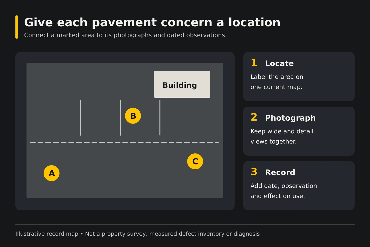
Choose a simple map that people can understand
A pavement defect map is a location record, not a technical design. Its purpose is to show where visible concerns occur so the owner and contractor can discuss the same areas. Start with a simple sketch, a property plan you are allowed to use or an overview image that reasonably represents the site. Identify the building, entrances and major travel paths. A clear handwritten sketch is often more useful than a detailed aerial image with unexplained markings. Include the exact property address and the date of the observation.
Explain whether the map covers the whole property or only a selected work area. If some surfaces were not inspected, label them as outside the observation rather than leaving a misleading blank space. Avoid treating an old aerial image as a current measurement source. Buildings, parking layouts and pavement boundaries can change. The map supports communication, while final construction dimensions and conditions need their own review.
Give each concern a stable reference
Assign a short reference to each visible condition, such as area A or entrance 1. Use the same reference on the photographs and written notes. Keep the labels stable when new observations are added so earlier discussions remain understandable. If one large area contains several different concerns, give the individual locations separate references rather than using one broad mark for everything. This helps a contractor distinguish a recurring pothole from nearby cracking or ponding.
Choose symbols or colors that are easy to explain and include a small legend. Do not rely on color alone because copies may be printed in grayscale or viewed on a different screen. A numbered marker with a plain-language note works well. Keep the legend focused on observations, such as crack, low area or broken edge. Avoid assigning a technical cause or construction method through the symbol before the property has been reviewed.
Describe visible conditions consistently
Use the same type of note for each location: what is visible, approximately where it is, how it affects use and when it was observed. A short statement such as broken edge beside the delivery turn is more useful than a dramatic label with no context. Add a photograph reference and any approximate dimensions you have. Mark estimates clearly as approximate. Do not convert a visual observation into an assumed repair depth or pavement specification.
Where several types of distress overlap, record them separately within the same location. A cracked area that also holds water deserves both observations, but the map should not declare that one caused the other. Note whether the condition changes after rain or repeated traffic. Consistent language makes later comparisons easier. It also helps keep the map useful when a different employee or property manager continues the maintenance record.
Record use and operational effects
Show the normal paths used by vehicles and pedestrians, especially where they pass the marked conditions. Identify deliveries, waste collection, loading activity and entrances that must remain available. The significance of a defect depends partly on how the area is used. A small problem at a busy entrance can require a different planning discussion from a larger concern in an infrequently used corner. Describe the operational effect without assuming that visible size alone determines priority.
If a condition interferes with access, explain the actual issue and who is affected. Do not label a temporary detour as suitable without reviewing it for the property's users. The map can identify an alternative route for discussion, but the responsible parties must confirm it. Include known scheduling constraints beside the relevant area. This gives the contractor useful context when discussing whether work can be grouped or needs separate phases.
Keep water notes separate from diagnosis
Mark where water remains or moves after rain and record the timing of the observation. Include nearby drain inlets, ditch edges, downspouts and retained pavement connections that are visible. A water observation can be attached to the same reference as a pavement concern while remaining a separate note. Avoid drawing a flow arrow as a confirmed drainage design when it represents only what you saw during one event.
If repeated observations show a pattern, retain the earlier notes rather than overwriting them with the newest conclusion. A dated record may reveal that a location behaves differently under different conditions. Photographs support that discussion, but they cannot establish every underlying cause. Do not enter traffic or flooded areas to complete the map. An inaccessible section can be marked for later review instead of filling the gap with a guess.
Distinguish priorities from approved repairs
Create a separate field for the owner's priority and another for the agreed work status. A location can be important without having an approved repair method. For example, a customer entrance may be the first area to discuss while the contractor is still reviewing the appropriate scope. Keep labels such as observe, discuss and approved distinct. This prevents a planning map from being treated as an instruction to perform work that has not been authorized.
When an estimate is accepted, attach its work limits to the relevant map references. Record what is included and what remains outside the scope. If the proposed boundary differs from the visible defect outline, preserve both rather than silently replacing one with the other. Ask the contractor to explain that difference during the quote discussion. The map should help compare decisions, not conceal the reasoning behind them.
Use the map to compare and phase proposals
Ask each contractor to refer to the same locations when describing a proposal. This makes differences in repair area, preparation and exclusions easier to spot. A price covering areas A and B should not be compared directly with one covering only A. Mark optional work separately and identify any assumptions that remain unresolved. If the contractor proposes a different grouping, record it in a revised planning layer or clearly dated copy.
For phased work, show which references belong to each phase and what access remains available between them. Include the connections between repaired and retained surfaces. Do not assume that a map alone communicates construction sequencing, temporary barriers or reopening requirements. Keep a written phase description with it. The combination gives property staff a practical record they can use when communicating with tenants, employees and service providers.
Maintain the record after the project
After work is completed, mark the locations addressed and attach final photographs, approved changes and reopening guidance. Keep the original observations so later maintenance discussions have a history. A completed map does not prove the condition of material that cannot be seen, and it should not be presented as an engineering inspection. Its value is the organized relationship between the original concern, agreed scope and recorded result.
Set a practical review habit based on the property's operation, and note new concerns using the same references or new ones that do not overwrite old records. Share the relevant map and photos when contacting Asphalt Solutions about a quote. Include the exact address and the main decision you want to discuss. The company serves Greater New Orleans and the Northshore; the Slidell contact location is by appointment only. A clear record helps the next conversation begin with facts rather than an uncertain recollection.
A simple revision date matters whenever the map changes. Save the earlier copy, identify the new version and tell anyone using the previous map which decision changed. If a contractor has already priced an older boundary, ask whether the revised map changes the estimate before treating the price as current. This prevents an innocent drawing update from becoming an unapproved scope change. Keep the file name, property address and date consistent across the map, photo folder and estimate so the record remains understandable when handed to another manager. Keep the final map accessible to the people arranging maintenance so it remains useful beyond the current estimate.
Questions before you request the estimate
Turn the property facts into a clear next step
Explore the asphalt repair service guide, project planning checklists and photo gallery. Bring the actual property address, useful photographs and access needs to the quote discussion.